Jabalpur | Madhya Pradesh | Mysahar.in

About Jabalpur Madhya Pradesh.
Jabalpur is a major city located in Madhya Pradesh. It is also one of the most populated cities in the state. this city is known for its special sculptures made of marble, ruins of Hindu places, palaces, ancient forts, and history.
It is also known as the financial capital of Madhya Pradesh as well as a well-known education center of India, due to which lakhs of students turn to this city every year to complete their studies. Large-scale industrial and trading activities continue here. Due to which this city is also a reason of remove unemployment in Madhya Pradesh.
Lakhs of people come here from other cities to work in these industries. There are abundant deposits of minerals like manganese, fireclay, iron ore, limestone, etc. Being the administrative headquarters of Madhya Pradesh, the High Court of Madhya Pradesh is situated here.
In the 14th century, it used to be the kingdom of Gondvanshi kings. Which was later taken over by the Maratha kings. According to the census, about “12 lakh 68 thousand” people reside here. Where mainly Hindi and some people use Urdu languages as their daily language.
Famous Roads.
- National Highway (NH 45)
- Andherdeo Road
- Damoh Road
- Kachhpura Over Bridge
- MR-4 Road
- Ukhri Road
- Katangi Road
- Amkhera Road
- Parel Line Road
- Railway Station Road
- Civil Line Road
- Science College Road
- Shastri Road
- Link Road
Famous Chowks.
- Gohalpur Square
- Abdul Hameed Chowk
- Raddi Chowk
- Damoh Naka
- Sarafa Chowk
- Adhartal Square Chowk
- Ghamapur Chowk
- Ambedkar Chowk
- Dr. Radha Krishna Chowk
- Mal Godam Chowk
- Spd Chowk
- Khajanchi Chowk
- Tularam Chowk
- Ranital Chowk
- Aaga Chowk
Rivers And Lakes.
- Narmada River
- Khandari Jheel
- Robertson Jheel
- Hitkarini Jheel
- Ganga Sagar Jheel
- Sangram Sagar Jheel
- Balsagar Talab
- Adhartal Talab
- Madhotal Talab
- Hanuman Tal Talab
- Rani Tal Talab
- Supa Tal Jheel
- Bagha Talab
- Imarti Talab
- Tal Talab
- Khamb Tal
- Bhairo Talab
- Hathital Talab
Ways Of Transportation.

Transportation is an essential element for the development of any city, which connects the city with many other cities and also makes trade easier. The following are the means of transportation here. The major ways of transportation here are roads, rail roots, and airways.
Roads – The NH-45, NH-30, and NH-34 are the three national highways that pass through this city, which connect this city to other cities like – Narsinghpur, Kundam, Sihora, Katangi, Patan, Shahpura, Mandla, and Lakhnadon together.
Railways – this city has several railway stations but there are three major stations operating here their names are (Jabalpur Station, Madan Mahal, and Gwarighat Station). Its main station code is (JBP), The length of this station is about 794.47 meters and the width is about 136.60 meters. A total of 144 trains run at this station. Its next station is Madan Mahal station and its fourth is Adhartal.
Airways – This city has an airport called (Jabalpur Airport) which is situated 15.7 km away in the east direction of the main city. it takes hardly 25 to 33 minutes to reach there. it’s a domestic airport so you can’t take international flights from this airport.
Pin Code Of City.
people also search on the internet that what is the pin code of this city. The full form of the PIN Code is Postal Index Number Code. And the pin code of the city’s Head Office is – “482001”
Distance From Major Cities.
- Sagar – 146 km
- Satna – 182 km
- Rewa – 205 km
- Nagpur – 241 km
- Bilaspur – 254 km
- Durg – 259 km
- Banda – 261 km
- Bhopal – 261 km
- Bhilai – 262 km
Latest Weather Updates.
The average temperature of this city is around 31.8°C in summer and 19.6°C in winter. And here on average 1291mm (85.84 inches), every year of precipitation falls. It rains here for about 55.2 days every year. For today’s weather information on this city, click on the link given below.
- Weather-forecast.com
- Theweathernetwork.com
- Weatherbug.com
News Agencies.
A list of some famous local news agencies is given below. These include newspapers, magazines, local news channels, etc.
- Sahara Samay
- News Vision India
- Suhane News Agency
- News Express
- Digital Bharat News
- Darpan News
- Insight India News
- Bhaskar Live
- MP Hindi Express
- Patrika
- Tripuri Times
Best Parks.
- Dumna Nature Reserve Park
- Madhuwan Park
- Ridge Road Children’s Park
- Rawan Park
- Shail Parn Udyan
- Walking Plaza
- Pillai Park
- Saraswati Garden
- Tagore Garden
- Jai Prakash Nagar Park
Best Hospitals.
- Marble City Hospital
- Metro Hospital
- Shalby Hospital
- Aditya Hospital
- KJ Memorial Hospital
- Kajal Maternity & Children’s Hospital
- Ashish Hospital
- Best Super Speciality Hospital
- Mahakaushal Hospital
- Anant Multispecialty Hospital
Best Hotels.
- Vijan Mahal
- Hotel Prince Viraj
- Narmada Jacksons
- Hotel Polo Max
- Samdariya Inn
- Kalchuri Residency
- Hotel Vijan Palace
- Hotel Rishi Regency
- Hotel Satyam Residency
- Samdareeya hotel
Best Schools.
- Delhi Public School Junior
- Royal Senior Secondary School
- Green Valley Public School
- Mount Litera Zee School
- Aditya convent school
- Christ Church Boys School
- Joy Senior Secondary School
- Gyan Ganga International School
- Ashoka Hall School
- Wisdom Public School
Best Colleges.
- Govt. Science College
- Saint Aloysius College
- Gyan Ganga Institute of Technology & Sciences
- GS College of Commerce and Economics
- Hitkarini College of Engineering and Technology
- Netaji Subhash Chandra Bose Medical College
- City Engineering College
- St.Aloysius College (Autonomous)
- Kalaniketan Polytechnic College
- City College of Computers and Communication
Geography Of Jabalpur.

Its area code is – 0761. Its height is about 412 meters above sea level. Here the registration of vehicles is done in “MP-20”. this city has an area of 367 sq. km. There is a total of “36 Police Stations” located here.
Official Government Websites.
- Official website of this city – Click here.
- Municipal Corporation’s website – Click here.
- Official Police Website – Click here.
Famous Areas Of City.
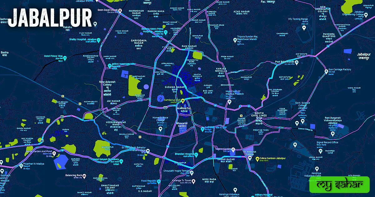
- Sudama Nagar
- Ranjhi
- Kanjar Mohalla
- Baldeobagh
- Sadar Bazar
- Gurandi
- Damoh Naka
- New Adarsh Colony
- Andhuwa
- Kugawan
- Shri Ram Nagar
- Khamaria
- Vehicle Factory
- Azad Nagar
- Pipariya
- Modi Bada
- Tagore Nagar
- Bagwan Nagar
Famous Places To Visit.
Tourist Attractions –
- Treasure Island Mall
- Dhuandhar Falls
- Sea World Water Park
- Balancing Rock
- South Avenue Mall
- Tilwara Ghat
- Madan Mahal Fort
- Bhedaghat
- Amdariya Mall
- Rani Durgavati Museum
- Bhawartal Garden
- Sangram Sagar Lake
- Dumna Nature Reserve
- Bargi Dam
- Lord Shiva Statue
- Kanha National Park
- Gwari Ghat
Temples & Mosques –
- Kachnar City Shiva Temple
- Swayambu Sidhpeeth Sri Gupteshwar Mahadev Mandir
- Paat Baba Mandir
- ISKCON Jabalpur
- Jama Masjid Ahle Sunnat Wal Jamaat
- Gayatri Mandir
- Jama Masjid Jahangirabad
- Prem Mandir
- Lakadganj Masjid
- Katra Masjid
Restaurants & Cafes –
- Badkul Restaurant
- Crystal
- Asanzo (Fast Food)
- Panchvati Gaurav
- 70 mm Dining
- Kamling Chinese Restaurant
- Moti Mahal
- The Melting Pot
Movie Theaters –
- Samdariya Era Cinema
- Movie Magic
- S R cinema
- Kalpna Cinema Auditorium
- Open Air Cinema
- Sharda Cineplex (Sharda Talkies)