Moradabad | Uttar Pradesh | Mysahar.in

About Moradabad Uttar Pradesh.
Moradabad is a big named city located 99 km away from Bareilly in the Uttar Pradesh state which is famous for its unique variety of cuisines and huge industries. those number is more than Nine thousand, including brass manufacturing, iron manufacturing, aluminum manufacturing, glass, and mint manufacturing factories. Not only are the raw materials manufactured but their carvings are done by experienced craftsmen.
These goods are manufactured on such a large scale that Moradabad gets a profit of about “Four thousand five hundred crores” every year from the production of these industries, which is increasing every year. The manufactured goods are so much that they are exported to other states of India as well as abroad. Some of the major countries like Germany, Italy, the UK, the USA, and Canada.
So much brass has been made in Moradabad that this city is also called the “city of brass”. Agriculture is also done here on a large scale, mainly sugarcane, cotton, and wheat are grown. Talking about food, Litti Chokha, Moradabadi Kebab, Special Biryani, and Matka Mutton is famous here. The Moradabad city was built by “Rustam Khan” in 1625. Which he named after his son “Prince Murad Baksh”.
Before the 19th century, Moradabad was under Rohilkhand which was later separated. The Jama Masjid established here was also built by Rustam Khan. According to the census about “8 lakh 87 thousand” people live here. In which the sex ratio is 903 females per 1000 males. The people of Moradabad use Urdu, Hindi, and Bhojpuri languages in their daily life.
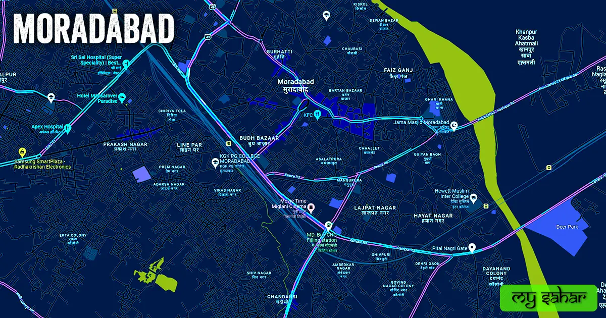
Famous Roads.
- Kanth / Bijnor Road
- Bypass Road
- Sambhal Road
- Amroha / Pakbara Road
- Chandausi Road
- Bahjoi Road
- Delhi Road
- Majhola Road
- Hanuman Mandir Road
- Rampur Road
- Lakri Fazalpur Road
- Kashipur Road
- Prince Road
- Pandit Nagla Bypass Road
- RRK Mora Road
- Civil Line Road
- Stadium Road
Famous Chowks.
- Peeli Khoti Circle
- Jain Mandir Circle
- Government Inter College Chowk
- Gaagan Tiraha
- Mandi Chowk
- Galshaheed Chouraha
- Fawaara Chowk
- Lal Bagh Chouraha
- Indira Chowk
- Dr. Athar Ali Chowk
- Hanuman Murti Tiraha
- Prakash Nagar Chowk
- Kapoor Company Chouraha
- Budh Bazar Chouraha
- Rampur Road Chowk
Rivers And Lakes.
- Ramganga River
- Gagan Nahar
- Mansarover Water Tank
- Overhead Water Tanks of the city
Ways Of Transportation.

Transportation is an essential element for the development of any city, which connects the city with many other cities and also makes trade easier. The following are the means of transportation in Moradabad. The major ways of transportation here are roads, rail roots, and airways.
Roads – NH-734, NH-9, NH-509, SH-49, SH-78, and SH-43 are the four national and state highways that pass through Moradabad, which connect this city to other neighboring cities like – Rampur, Kashipur, Chandausi, Sambhal, Joya, Amroha, Rudrapur, Hapur, and Bareilly together.
Railways – Moradabad has many railway stations. one primary and daily operational station is (Moradabad Junction). the station code of Its main stations is (MB). this station is located in the middle of the city Its length is about 1.35 km and the width is approximately 74.57 meters. a total of 198 trains operating here and it has 6 platforms in operation.
Airways – Unfortunately, Moradabad doesn’t have an airport so for any flight you have to travel to its nearest airport known as (Bareilly Airport). which is located in the southeast direction and 93.5km far away from here. it takes 1 hour 51 minutes to reach there.
Pin Code Of City.
People also search on Google what is the pin code of Moradabad. The full form of a Pin Code is Postal Index Number Code. And the pin code of the city’s head office is – “244001”.
Distance From Major Cities.
- Rampur – 24 km
- Amroha – 31 km
- Bareilly – 81 km
- Hapur – 98 km
- Meerut – 107 km
- Aligarh – 126 km
- Muzaffarnagar – 128 km
- Ghaziabad – 133 km
- Noida – 140 km
- Roorkee – 143 km
Latest Weather Updates.
Moradabad has an annual average high temperature of 30.4°C and an average minimum temperature of about 18.7°C. And it receives an average of 926.5 millimeters (36.48 in) of rain annually. Click on the links below to get today’s weather information for this city.
- Myweather2.com
- Ventusky.com
- Weather.interia.com
News Agencies.
A list of some famous local news agencies of Moradabad city is given below. These include newspapers, magazines, local news channels, etc.
- Live Hindustan
- ABPS News
- Sahara 9 Tv News
- Ishaan
- Zen1News
- News Global
- Aapki Chopal News
- Newsy Bird
- Jagran
- Amarujala
Best Parks.
- Ambedkar Park
- Gautam Budh Park
- Avantika Park
- Jhoola Park
- MDA Park
- Gangotri Park
- Shri Ram Park
- Sarvoday park
- Eco Herbal Park
- Shiv Park
Best Hospitals.
- Asian Vivekanand Super Speciality Hospital
- Sri Sai Hospital
- Ujala Cygnus BrightStar Hospital
- Cosmos Hospital
- Anushka Hospital
- Mahanagar Hospital
- Anand Hospital
- Pt. Din Dayal Upahadhy
- Maryada Hospital
- Medicity Hospital
Best Hotels.
- Amara Gateway Hotel
- Holiday Regency
- Hotel Taj International
- Hotel Pratiksha
- Drive-In 24 Hotel & Resto
- Hotel Grand Sai
- MB Greens Clarks International
- Midtown Hotel & Banquet
- Hotel Mansarover Paradise
- New Maharaja Hotel
Best Schools.
- Saint Mira Academy
- Delhi Public School
- KCM School
- Aryans International School
- Modern Public School
- Ideal Public School
- C. L. Gupta World School
- VKS Public School
- PMS Public School
- Gandhi Nagar Public School
Best Colleges.
- KGK PG College
- Hindu College
- M.H. PG College
- Mayfair College
- Muslim Degree College
- MIT College of Management
- Springfields College
- Dayanand Arya Kanya Degree College.
- Wilsonia Degree College
- St. Paul’s College
Geography Of Moradabad.

The area code of Moradabad’s head office is – (0591). Its height is about (198 meters) above sea level. Here the registration of vehicles is done in “UP-21”. The area of this city is 94.86 km² and the border is about 48.28 km. There’s a total of “17 Police Stations” situated in this city.
Official Government Websites.
- Official website of Moradabad – Click here.
- Municipal Corporation’s website – Click here.
- Official Police Website – Click here.
Famous Areas Of City.
- Budh Bazar
- Majhola
- Chandausi
- Karula
- Guiyan Bagh
- Lain Par
- Mohra Ki Milak
- Tilokpur
- Sonakpur
- Chiriya Tola
- Dayanand Colony
- Bhensiya
- Dehri Gaon
- Mangupura
Famous Places To Visit.
- Bala Ji Mandir
- Jama Masjid
- Dwarikadhish Temple
- Shree Radha Krishna Mandir
- Manokamna Mandir
- Sai Mandir
- Radha Krishna Mandir
- Hathi Wala Mandir
- Wave Mall
- Parsvnath Mall
- Krishna Complex
- Mansarover Shopping Complex
- Crossroad Mall
- Shake It Up Cafe
- Waffles Town Cafe
- The Cult Cafe
- Chai Nagri
- HAV Stories Cafe
- The Cult Cafe
- Prem Wonderland & Water Kingdom
- Gautam Budh Park
- Eco Herbal Park
- Murari Chat
- Multani Chhole Chawal Centre
- Wave Cinemas
- Movie Time Miglani Cinema
- PVR CINEMAS