Banda | Uttar Pradesh | Mysahar.in

Banda, Uttar Pradesh: A Complete Guide.
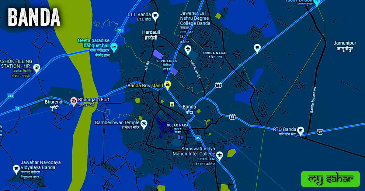
The city of Banda is situated on the banks of the Ken River, which flows through Uttar Pradesh. The river runs through the city’s center, although most of it is located on the eastern bank of the river. Banda City is the first choice of people for its history, ruins of ancient buildings from the 18th century, tourist places, and special types of ‘Gomed gems’ found here as well as ‘Shajar stones’.
It is also a fact that Maharishi Vamdev did severe penance here in ancient times to please the Gods and Goddesses. Valuable gems found here, like ‘Gomed’ and ‘Shajar’ stones, are taken out of the Ken River passing through the city and exported to the country and abroad, where beautiful ornaments are made from them. Apart from these, different types of granite stones are also found here. Due to this, the city is also economically strong. Historical buildings located in Banda include the Bhuragarh Fort and the temples of Shri Sankat Mochan Mandir. Where most tourists come to visit.
Melon, watermelon, cucumber, and other water-intensive crops are grown on the banks of the Ken River, a tributary of the Yamuna River, which is why it is also called the lifeline of Banda City. Industries like the PVC pipe factory, ice cream manufacturers, fruit processing factories, stone threshing factories, etc. have a big hand in strengthening the city’s economic condition.
According to the 2011 census, the population here was 1 lakh and 54 thousand, which is increased now. The languages spoken here include Bundeli and Urdu, along with Hindi, the official language here. The only radio station in Banda is 101.2 MHz AIR Banda (All India Radio Air Akashvani).
Famous Streets in Banda Worth Exploring.
- Atarra Road
- Baberu – Rajpur Road
- Tindwari Road
- Chilla Road
- Bundel Khand Expressway
- Mahoba Road
- Bypass Road
- Chota Bypass Road
- Kalu Kuan Road
- Jail Road
- Kyotra Road
- Mayur Talkies Road
- Balkhandi Naka Road
- Eidgah Road
Popular Chowks to Visit in Banda.
- Kalu Kuwan Chauraha
- Ashok Laat Chowraha
- Babulal Chouraha
- Maharana Pratap Chouraha
- Mandi Samiti Chouraha
- Banda Interchange
- Jhanda Chouraha
- Chungi Tiraha
- Sabji Mandi Time Square
Water source of Banda: Rivers and Lakes to Discover.
- Ken River
- Khandahar Das Lake
- Chhabi Talab
- Diggi Talab
- Basant Sarovar (Kaccha Talab)
- Nawab Tank
- Pragi Talab
- Canal (Nahar)
Getting Around Banda: Tips and Transportation Options.

Any city’s ability to develop is greatly influenced by its transportation infrastructure, which connects it to a number of other towns and promotes commerce. The following list of transit options is provided: This region’s primary means of transit consist of roads, train lines, and aircraft.
Roads – Two national highways, NH-35 and NH-335 state highways, SH-13, SH-92, and the Bundelkhand expressways are the major highways that pass through this city and connect it to other big cities, including Fatehpur, Chhatarpur, Atarra, Mahoba, Raebareli, and Prayagraj.
Railways – this city has a station called Banda railway station. The station’s code is (BNDA). Its width is 65.29 meters, and its length is approximately 924.74 meters. It’s part of the North Central Railway of India. A total of 33 trains are operating from this station, which has three platforms.
Airways – Banda does have helipads but doesn’t have any airports. So, everyone traveling by air must fly to the airport that is closest to them, which is (Kanpur Airport). Its IATI code is (KNU). The distance from Banda to this airport is approximately 126 kilometers in a northerly direction. To reach there, it takes around 3 hours and 11 minutes.
Simplify Destination Locating with Banda’s Pin Code.
People also look for the pin code of this city on the internet. Postal Index Number Code is the full name of the PIN code. And “210001” is the pin code for the city’s administration center.
Banda’s Proximity to Major Cities: A Convenient Travel Guide.
- Atarra – 33km
- Baberu – 39km
- Chilla – 40km
- Mahoba – 53km
- Kanpur – 125km
- Orai – 138km
- Raebareli – 142km
- Unnao – 163km
- Prayagraj – 190km
- Lucknow – 197km
Stay Up-to-Date with Banda’s Weather Forecast.
This city’s typical temperature is approximately 26°C. 42°C is the highest recorded, and 9°C is the winter record. And the annual average rainfall in this area is 601.4mm (23 inches). Here, it rains for roughly 84 days a year. Click the link below to get the local weather for today.
- Weather.com
- Weatheronline.co.uk
- Timeanddate.com
- Accuweather.com
Experience Jaunpur: Watch our YouTube Video.
Overview of News Agencies Operating in Banda.
A list of some famous local news agencies is given below. These include newspapers, magazines, local news channels, etc.
- Bundelkhand News
- Samarneeti News
- Darshnik Samachar
- UP News Box
- Dainik Jagran
Best Parks in Banda for Nature Lovers.
- Sardar Vallabhbhai Patel Oxygen Park
- Van Chetana Park
- Children Park Police Line
- Ambedkar Park
- Awasthi Park
- Kanshiram Smriti Upvan
- Udyan and Khadya Prasanskaran Vibhag
- Ashirwad Park
Top Hospitals in Banda for Medical Assistance.
- Rafique Nursing Home
- Shri Rajaram Memorial Eye Hospital
- District Homoeopathic Hospital
- City Medical Centre
Best Accommodations in Banda for a Comfortable Stay.
- Hotel Sarang Intercontinental
- Hotel Bharat Emperial
- SS Residency
- Hotel Comfort Inn
- Hotel Tulsi Swaroop
- City Garden Marriage Hall
- Hotel Gurudev Palace
- Hotel Grand Darbar
- Hotel Shri Kanth Basu
- Atithi Hotel
Top Schools in Banda for Quality Education.
- St. Mary’s Senior Secondary School
- Vidyawati Nigam Memorial Public School
- Sant Tulsi Public School
- Bhagwat Prasad Memorial Academy
- St. Xavier’s High School
- Bachpan Play School
- Jawahar Navodaya Vidyalaya
- H L Inter College
- Rajaram Memorial School
- Tulsa Devi Public School
Best Colleges in Banda for Higher Learning.
- Rani Durgavati Medical College
- Jawahar Lal Nehru Degree College
- Banda University of Agriculture and Technology
- Knowledge Institute of Professional Studies
- Pt. J.N. Degree College
- I.T.I. (Industrial Training Institute)
- Adarsh Bajrang Inter College
- Raja Devi Degree College
- Saraswati Vidya Mandir Inter College
- Government Polytechnic College
Quick Overview of Banda Political Map.

This city has an STD code of (05192) and is situated around 123 meters above sea level. Vehicle registration is carried out at “UP-90” in this location. This city has a (20.54 km²) square area, and the boundary is around 24.76 km long. This city contains a total of “7 Police Stations”.
Official Government Websites: Your Guide to Banda Online.
- Official website of this city – Click here.
- Municipal Corporation’s website – Click here.
- Official Police Website – Click here.
Famous Areas of Banda: A Local’s Guide.
- Hardauli
- Kalu Kuwana
- Gayatri Nagar
- Ladka Purwa
- DM Colony
- Sarvodaya Nagar
- Tulsi Nagar
- Indira Nagar
- Shastri Nagar
- Ali Ganj
Must-Visit Places in Banda: Top Attractions and Landmarks.
Tourist Attractions –
- Bhuragarh Fort
- 1 India Family Mart
- Vishal Mega Mart
- Ken River Bridge
- Hoisting Flag
- Sheesh Mahal
Temples & Mosques –
- Sri Sankat Mochan Mandir
- Bambeshwar Temper
- Hafeez Abmad Imambara
- Rabbaniya Masjid
- Kali Devi Mandir
- Noorani Masjid
- Shri Lodheswar Mahadev Temple
Restaurants & Cafes –
- Nirmal Brij Restaurant
- Deep Dhaba
- Hide Out Pizza
- Sai Darbar Restaurant
- The Central Jail Restaurant
- Pizza Hot Family Restaurants
- Sri Ram Samosa Bhandar
